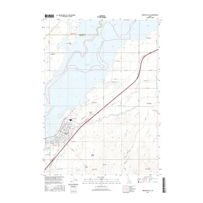
2017 Map of American Falls
USGS Topo · Published 2017About this map
The American Falls Reservoir dominates this Idaho landscape, where the waters of the Snake River are harnessed for both power and irrigation. The city of American Falls is positioned along the southwestern shore, revealing a detailed street grid and the nearby American Falls Airport. This 2017 survey illustrates the complex water management system essential to the region, featuring the Main W Canal and numerous laterals that support local agriculture. Beyond the water's edge, the terrain rises toward landmarks such as Pops Mtn and Lone Rock, while the northern reaches include Fenstermaker Point and the small settlement of Fairview. Genealogists and local historians can locate the Falls View Cem overlooking the river and trace the various recreational points like Seagull Bay that define the modern shoreline.
Find a feature on this map
1 named feature on this map. Tap any name to fly to it.
Don’t see what you’re looking for? This feature index may not catch every label — zoom into the map to look around manually.
Map Details
Editions of this 2017 American Falls Map
This is the sole edition of this map. No revisions or reprints were ever made.
Other maps of this area

1934 · American Falls
USGS Topo · 1:62,500

1934 · Michaud
USGS Topo · 1:62,500

1934 · Rockland
USGS Topo · 1:62,500

1936 · American Falls
USGS Topo · 1:62,500

1937 · Rockland
USGS Topo · 1:62,500

1937 · Michaud
USGS Topo · 1:62,500

1938 · Pauline
USGS Topo · 1:48,000

1944 · Arbon
USGS Topo · 1:62,500

1954 · Pocatello
USGS Topo · 1:250,000

1958 · Pocatello
USGS Topo · 1:250,000