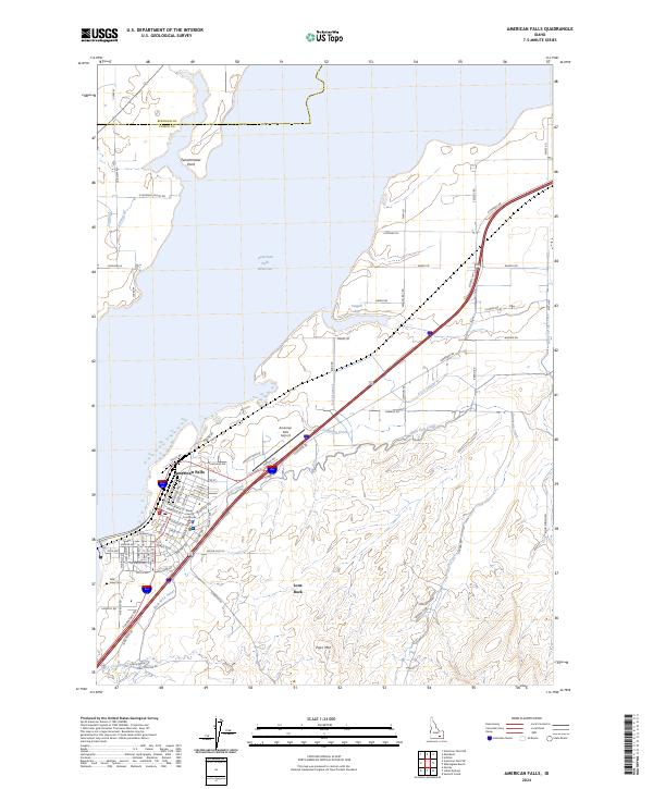
2024 Map of American Falls
USGS Topo · Published 2024About this map
American Falls serves as the focal point of this Idaho landscape, dominated by the expansive American Falls Reservoir to the north and west. The town's grid is clearly defined, housing the Power County Courthouse and extending toward the American Falls Airport. Evidence of the region's agricultural engineering is prominent through an extensive network of irrigation features, including the East Canal, Main West Canal, and numerous laterals like E 4.6 Lateral and Lateral Q.
Find a feature on this map
98 named features on this map. Tap any name to fly to it.
Don’t see what you’re looking for? This feature index may not catch every label — zoom into the map to look around manually.
Map Details
Editions of this 2024 American Falls Map
This is the sole edition of this map. No revisions or reprints were ever made.
Other maps of this area

1934 · American Falls
USGS Topo · 1:62,500

1934 · Michaud
USGS Topo · 1:62,500

1934 · Rockland
USGS Topo · 1:62,500

1936 · American Falls
USGS Topo · 1:62,500

1937 · Rockland
USGS Topo · 1:62,500

1937 · Michaud
USGS Topo · 1:62,500

1938 · Pauline
USGS Topo · 1:48,000

1944 · Arbon
USGS Topo · 1:62,500

1954 · Pocatello
USGS Topo · 1:250,000

1958 · Pocatello
USGS Topo · 1:250,000