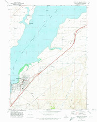
1971 Map of American Falls
USGS Topo · Published 1974About this map
The American Falls Reservoir dominates this landscape along the Snake River, reflecting the complex water management infrastructure of the early 1970s. The town of American Falls is mapped in detail, showing its civic core with the Co Hospital, City Park, and Municipal Golf Course. This survey captures the critical junction of transportation and power, from the American Falls Dam and its adjacent Powerplant and Substation to the heavy transit corridor of the Union Pacific railroad and the American Falls Airport.
Find a feature on this map
32 named features on this map. Tap any name to fly to it.
Don’t see what you’re looking for? This feature index may not catch every label — zoom into the map to look around manually.
Map Details
Editions of this 1971 American Falls Map
This is the sole edition of this map. No revisions or reprints were ever made.
Other maps of this area

1934 · American Falls
USGS Topo · 1:62,500

1934 · Michaud
USGS Topo · 1:62,500

1934 · Rockland
USGS Topo · 1:62,500

1936 · American Falls
USGS Topo · 1:62,500

1937 · Rockland
USGS Topo · 1:62,500

1937 · Michaud
USGS Topo · 1:62,500

1938 · Pauline
USGS Topo · 1:48,000

1944 · Arbon
USGS Topo · 1:62,500

1954 · Pocatello
USGS Topo · 1:250,000

1958 · Pocatello
USGS Topo · 1:250,000