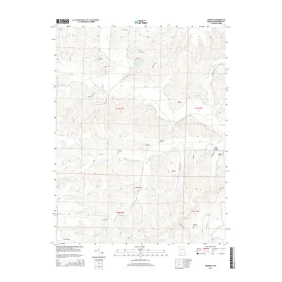
2015 Map of Americus
USGS Topo · Published 2015About this map
The Loutre River and its numerous tributaries, including Dry Fork, Prairie Fork, and Pinch Cr, dominate this section of Montgomery County. The small community of Americus sits central to a landscape defined by its rural cemetery network, which serves as a vital record of local family history. Genealogists can trace lineages through sites such as Bryant Cemetery, Hunter Cemetery, and Kendrick Cemetery. The map also reveals the area's educational and communal roots through roads like Freedom School Rd and Whiteside School Rd. In the eastern portion, the landmark Big Spring near Possum Hollow highlights the natural hydrology that likely influenced early settlement patterns. Several reservoirs, including Loutre Valley Lake and Allgeyer Lake, indicate a landscape modified for local water management and recreation in more recent decades.
Find a feature on this map
69 named features on this map. Tap any name to fly to it.
Don’t see what you’re looking for? This feature index may not catch every label — zoom into the map to look around manually.
Map Details
Editions of this 2015 Americus Map
This is the sole edition of this map. No revisions or reprints were ever made.
Other maps of this area

1890 · Hermann
USGS Topo · 1:125,000

1890 · Fulton
USGS Topo · 1:125,000

1935 · Morrison
USGS Topo · 1:48,000

1936 · Hermann
USGS Topo · 1:48,000

1940 · Montgomery City
USGS Topo · 1:62,500

1942 · Montgomery City
USGS Topo · 1:62,500

1942 · Morrison
USGS Topo · 1:62,500

1942 · Hermann
USGS Topo · 1:62,500

1942 · New Florence
USGS Topo · 1:62,500

1945 · Hermann
USGS Topo · 1:62,500