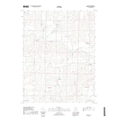
2017 Map of Americus
USGS Topo · Published 2017About this map
Americus sits at the heart of this Montgomery County landscape, where the Loutre River and its numerous tributaries carve a complex drainage pattern through the Missouri terrain. The map reveals a deeply rooted rural community, marked by family and local landmarks such as Graveyard Hill and the evocative Possum Hollow. Significant water features like Loutre Valley Lake and the Number 224 Reservoir provide focal points amidst a network of small creeks including Dishwater Cr, Dry Fork, and Prairie Fork.
Find a feature on this map
64 named features on this map. Tap any name to fly to it.
Don’t see what you’re looking for? This feature index may not catch every label — zoom into the map to look around manually.
Map Details
Editions of this 2017 Americus Map
This is the sole edition of this map. No revisions or reprints were ever made.
Other maps of this area

1890 · Hermann
USGS Topo · 1:125,000

1890 · Fulton
USGS Topo · 1:125,000

1935 · Morrison
USGS Topo · 1:48,000

1936 · Hermann
USGS Topo · 1:48,000

1940 · Montgomery City
USGS Topo · 1:62,500

1942 · Montgomery City
USGS Topo · 1:62,500

1942 · Morrison
USGS Topo · 1:62,500

1942 · Hermann
USGS Topo · 1:62,500

1942 · New Florence
USGS Topo · 1:62,500

1945 · Hermann
USGS Topo · 1:62,500