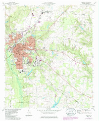
1973 Map of Americus
USGS Topo · Published 1986About this map
Georgia Southwestern College anchors the southwestern district of this city, which in the early 1970s was a hub of transport and education for the region. The landscape is defined by the convergence of the Central of Georgia and Seaboard Coast Line railroads, which facilitated local trade across the fertile Sumter County terrain. Aviation history is noted at Souther Field to the north, while the residential core of Americus displays a grid of street names including Lee St, Lamar St, and Forsyth St.
Find a feature on this map
71 named features on this map. Tap any name to fly to it.
Don’t see what you’re looking for? This feature index may not catch every label — zoom into the map to look around manually.
Map Details
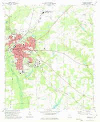
Editions of this 1973 Americus Map
2 editions found
Other maps of this area

1953 · Dothan
USGS Topo · 1:250,000

1954 · Dothan
USGS Topo · 1:250,000

1955 · Dothan
USGS Topo · 1:250,000

1955 · Phenix City
USGS Topo · 1:250,000

1956 · Leslie
USGS Topo · 1:62,500

1957 · Phenix City
USGS Topo · 1:250,000

1958 · Phenix City
USGS Topo · 1:250,000

1972 · Ellaville South
USGS Topo · 1:24,000
1972 · Methvins
USGS Topo · 1:24,000
1972 · Andersonville
USGS Topo · 1:24,000