
1960 Map of Amesville
USGS Topo · Published 1962About this map
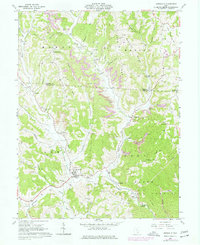
Amesville and its surrounding hill country reveal a landscape shaped by coal and timber at the start of the 1960s. The village lies at the confluence of Linscott Run and Federal Creek, with transportation history preserved through the Railroad Grade and Sharps Grade routes. The hillsides are marked by the extractive industries of the era, from numerous Strip Mines to scattered Gas Wells and a Compressor Station.
Find a feature on this map
52 named features on this map. Tap any name to fly to it.
Don’t see what you’re looking for? This feature index may not catch every label — zoom into the map to look around manually.
Map Details
Editions of this 1960 Amesville Map
4 editions found

Other maps of this area

1903 · Athens
USGS Topo · 1:62,500

1904 · Chesterhill
USGS Topo · 1:62,500

1905 · Athens
USGS Topo · 1:62,500

1906 · Chesterhill
USGS Topo · 1:62,500

1910 · Mc Connelsville
USGS Topo · 1:62,500

1911 · New Lexington
USGS Topo · 1:62,500

1947 · Columbus
USGS Topo · 1:250,000

1949 · Clarksburg
USGS Topo · 1:250,000

1956 · Clarksburg
USGS Topo · 1:250,000

1961 · Columbus
USGS Topo · 1:250,000