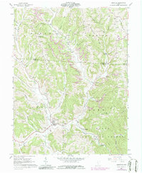
1960 Map of Amesville
USGS Topo · Published 1986About this map
Amesville serves as the focal point for this survey of the hilly borderlands between Morgan and Athens counties. The landscape is defined by the heavy footprint of the extractive industry, with numerous Strip Mines and gas wells scattered across the ridges and hollows. The village of Lathrop and the smaller settlement of Sharpsburg are connected by the Old Railroad Grade, which traces the winding path of Federal Creek. The terrain is steeply dissected, featuring prominent landforms like Sharps Ridge and Spurrier Ridge, while significant portions of the southern terrain are protected within the Wayne National Forest. Local heritage is preserved in several country churches and family-named burial grounds, including the Mound Hill Ch and the curiously named Mud Sock Cem. The presence of numerous named runs, such as Linscott Run and McElfresh Run, illustrates the dense drainage network that dictated early settlement patterns and transport routes in this portion of southeastern Ohio.
Find a feature on this map
61 named features on this map. Tap any name to fly to it.
Don’t see what you’re looking for? This feature index may not catch every label — zoom into the map to look around manually.
Map Details
Editions of this 1960 Amesville Map
4 editions found

Other maps of this area

1903 · Athens
USGS Topo · 1:62,500

1904 · Chesterhill
USGS Topo · 1:62,500

1905 · Athens
USGS Topo · 1:62,500

1906 · Chesterhill
USGS Topo · 1:62,500

1910 · Mc Connelsville
USGS Topo · 1:62,500

1911 · New Lexington
USGS Topo · 1:62,500

1947 · Columbus
USGS Topo · 1:250,000

1949 · Clarksburg
USGS Topo · 1:250,000

1956 · Clarksburg
USGS Topo · 1:250,000

1960 · Amesville
USGS Topo · 1:24,000