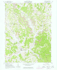
1960 Map of Amesville
USGS Topo · Published 1977About this map
Amesville and the surrounding townships of Homer, Marion, Ames, and Bern are depicted here during a period of transition in southeastern Ohio. The landscape is defined by the valley of Federal Creek and its many tributaries, such as Linscott Run and Kitten Run. While many small settlements like Sharpsburg, Lathrop, and Wrightstown anchor the area, the terrain is heavily marked by industrial activity, specifically numerous Strip Mines and a Tipple Strip Mine near the Morgan and Athens County line.
Find a feature on this map
63 named features on this map. Tap any name to fly to it.
Don’t see what you’re looking for? This feature index may not catch every label — zoom into the map to look around manually.
Map Details
Editions of this 1960 Amesville Map
4 editions found

Other maps of this area

1903 · Athens
USGS Topo · 1:62,500

1904 · Chesterhill
USGS Topo · 1:62,500

1905 · Athens
USGS Topo · 1:62,500

1906 · Chesterhill
USGS Topo · 1:62,500

1910 · Mc Connelsville
USGS Topo · 1:62,500

1911 · New Lexington
USGS Topo · 1:62,500

1947 · Columbus
USGS Topo · 1:250,000

1949 · Clarksburg
USGS Topo · 1:250,000

1956 · Clarksburg
USGS Topo · 1:250,000

1960 · Amesville
USGS Topo · 1:24,000