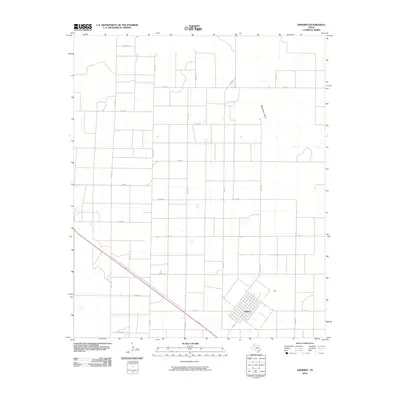
2010 Map of Amherst
USGS Topo · Published 2010About this map
Amherst anchors the southeastern corner of this West Texas landscape, appearing as a concentrated grid of streets at the junction of Fm 37 and several county routes. The surrounding terrain is defined by a rigorous network of section-line roads, such as Co Rd 125 and Co Rd 135, which facilitate the region's agricultural economy. This geometry is only interrupted by the meandering course of Blackwater Draw, which snakes through the northeastern portion of the quadrangle. The map reveals the persistence of rural infrastructure in Lamb County, where the layout of the land remains deeply tied to the township-and-range surveying system. Local transit is dominated by farm-to-market routes like Fm 1843 and a web of numbered county roads, illustrating the connectivity between isolated farmsteads and the central community of Amherst.
Find a feature on this map
22 named features on this map. Tap any name to fly to it.
Don’t see what you’re looking for? This feature index may not catch every label — zoom into the map to look around manually.
Map Details
Editions of this 2010 Amherst Map
This is the sole edition of this map. No revisions or reprints were ever made.
Other maps of this area

1954 · Clovis
USGS Topo · 1:250,000

1954 · Brownfield
USGS Topo · 1:250,000

1958 · Brownfield
USGS Topo · 1:250,000

1958 · Clovis
USGS Topo · 1:250,000

1962 · Brownfield
USGS Topo · 1:250,000

1962 · Amherst
USGS Topo · 1:24,000

1962 · Sudan
USGS Topo · 1:24,000

1962 · Muleshoe NE
USGS Topo · 1:24,000

1962 · Cofferville
USGS Topo · 1:24,000

1962 · Springlake
USGS Topo · 1:24,000