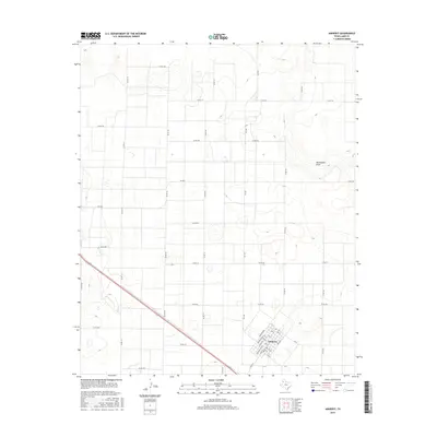
2016 Map of Amherst
USGS Topo · Published 2016About this map
Amherst stands as the primary hub of this Llano Estacado landscape, where the town's grid of residential streets like 7th St and 11th St contrasts with the broad agricultural expanses of Lamb County. The community's center includes the Po, serving a region defined by a precise network of county roads that facilitate the local farming economy. Outside the town limits, the terrain is shaped by the subtle depression of Blackwater Draw, a significant geographic feature of the South Plains. This map captures the structured intersection of state and local transit, with Fm 1055 and Fm 1843 providing vital links through the vast reaches of cropland. The arrangement of the landscape reflects the late 20th-century development of Texas panhandle agriculture, where transportation and water drainage features dictate the placement of local infrastructure.
Find a feature on this map
42 named features on this map. Tap any name to fly to it.
Don’t see what you’re looking for? This feature index may not catch every label — zoom into the map to look around manually.
Map Details
Editions of this 2016 Amherst Map
This is the sole edition of this map. No revisions or reprints were ever made.
Other maps of this area

1954 · Clovis
USGS Topo · 1:250,000

1954 · Brownfield
USGS Topo · 1:250,000

1958 · Brownfield
USGS Topo · 1:250,000

1958 · Clovis
USGS Topo · 1:250,000

1962 · Brownfield
USGS Topo · 1:250,000

1962 · Amherst
USGS Topo · 1:24,000

1962 · Sudan
USGS Topo · 1:24,000

1962 · Muleshoe NE
USGS Topo · 1:24,000

1962 · Cofferville
USGS Topo · 1:24,000

1962 · Springlake
USGS Topo · 1:24,000