
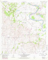
1957 Map of Ammannsville
USGS Topo · Published 1958About this map
The Colorado River carves a winding path through this central Texas landscape, where German and Czech heritage is evident in the rural social centers of Ammannsville and Holman. The 1950s terrain is marked by a network of local institutions that anchored these farming communities, including St Wenceslaus Ch, St Paul Ch, and Bethlehem Ch. The educational landscape is represented by the Hostyn Sch and Pecan Sch, alongside numerous family-named landmarks like Mullins Prairie and Cozy Corner.
Find a feature on this map
33 named features on this map. Tap any name to fly to it.
Don’t see what you’re looking for? This feature index may not catch every label — zoom into the map to look around manually.
Map Details
Editions of this 1957 Ammannsville Map
2 editions found
Other maps of this area

1919 · Fayettsville
USGS Topo · 1:62,500

1919 · Schulenburg
USGS Topo · 1:62,500

1953 · Seguin
USGS Topo · 1:250,000

1956 · Glidden
USGS Topo · 1:62,500

1956 · La Grange
USGS Topo · 1:62,500

1957 · Ellinger
USGS Topo · 1:24,000

1957 · La Grange East
USGS Topo · 1:24,000

1957 · Borden
USGS Topo · 1:24,000

1958 · La Grange West
USGS Topo · 1:24,000

1958 · Seguin
USGS Topo · 1:250,000