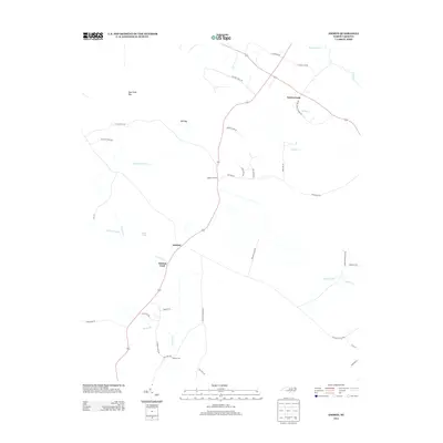
2013 Map of Ammon
USGS Topo · Published 2013About this map
Ammon and the rural communities of Cumberland County are defined by a network of drainage systems and agricultural lifelines. Significant water features including Turnbull Cr, Little Turnbull Cr, and the winding Peters Cr create a complex hydrographic landscape where historical crossings like Ammon Ford and Reeves Ford once provided vital passage. The terrain is marked by distinctive elliptical depressions known as Carolina bays, specifically Bear Path Bay and Mill Bay, which interrupt the woodland and farm plots. Modern agriculture and local heritage intersect along roads bearing family and farm names such as Murphy Farm Rd, Culbreth Smith Rd, and the uniquely named livestock-related routes like Hog Haven Dr and Pork Chop Dr. These roads reflect the localized industry and family-rooted land ownership patterns that have persisted in this corner of North Carolina into the early 21st century.
Find a feature on this map
43 named features on this map. Tap any name to fly to it.
Don’t see what you’re looking for? This feature index may not catch every label — zoom into the map to look around manually.
Map Details
Editions of this 2013 Ammon Map
This is the sole edition of this map. No revisions or reprints were ever made.
Other maps of this area

1953 · Florence
USGS Topo · 1:250,000

1954 · Florence
USGS Topo · 1:250,000

1954 · White Lake
USGS Topo · 1:62,500

1955 · Elizabethtown
USGS Topo · 1:62,500

1959 · Roseboro
USGS Topo · 1:62,500

1959 · Garland
USGS Topo · 1:62,500

1982 · Elizabethtown
USGS Topo · 1:100,000
1986 · Garland
USGS Topo · 1:24,000
1986 · Bonnetsville
USGS Topo · 1:24,000
1986 · White Lake
USGS Topo · 1:24,000