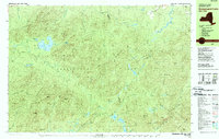
1978 Map of Ampersand Lake
USGS Topo · Published 1979About this map
The Adirondack Park interior, where the high peaks of the Sawtooth Mountains and Seward Mountains meet, defines this 1970s topographic landscape. This survey documents the critical hiking infrastructure of the era, most notably the Northville Placid Trail as it traverses the remote Franklin and Essex County line. The map highlights the primitive backcountry facilities at Wanika Falls Shelter and several other unnamed Shelters and a Ranger Sta near Duck Hole.
Find a feature on this map
61 named features on this map. Tap any name to fly to it.
Don’t see what you’re looking for? This feature index may not catch every label — zoom into the map to look around manually.
Map Details
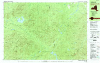
Editions of this 1978 Ampersand Lake Map
2 editions found
Other maps of this area

1895 · Mt. Marcy
USGS Topo · 1:62,500

1896 · Lake Placid
USGS Topo · 1:62,500

1898 · Lake Placid
USGS Topo · 1:62,500

1902 · Mt. Marcy
USGS Topo · 1:62,500

1902 · Saranac
USGS Topo · 1:62,500

1904 · Saranac
USGS Topo · 1:62,500

1904 · Santanoni
USGS Topo · 1:62,500

1904 · Long Lake
USGS Topo · 1:62,500

1905 · Saint Regis
USGS Topo · 1:62,500

1948 · Ogdensburg
USGS Topo · 1:250,000