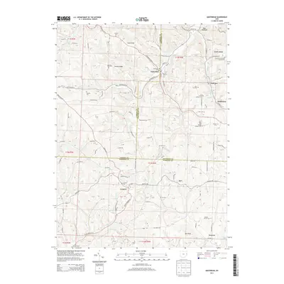
2013 Map of Amsterdam
USGS Topo · Published 2013About this map
Yellow Creek and its many tributaries, including Wolf Run, Cox Creek, and Goose Creek, carve through the complex topography of Jefferson, Carroll, and Harrison Counties. This 2013 survey of the Amsterdam area shows a landscape defined by its ridge-top settlements and deep-valley drainage. Genealogists find significant value in the high density of rural burial grounds, such as the Circle Green Methodist Episcopal Cemetery, Greek Orthodox Cemetery, and Old Buffalo Hill Cemetery. The pattern of development follows the high ground, with Simmons Ridge and Blue Ridge providing natural corridors for early roads like Germano Road. Smaller hamlets like Germano, Apex, and Middleburg are scattered throughout the quadrangle, connected by a network of winding county roads that trace the contours of Red Dog Ridge and Pigeon Ridge.
Find a feature on this map
107 named features on this map. Tap any name to fly to it.
Don’t see what you’re looking for? This feature index may not catch every label — zoom into the map to look around manually.
Map Details
Editions of this 2013 Amsterdam Map
This is the sole edition of this map. No revisions or reprints were ever made.
Other maps of this area

1901 · Cadiz
USGS Topo · 1:62,500

1902 · Scio
USGS Topo · 1:62,500

1903 · Cadiz
USGS Topo · 1:62,500

1904 · Scio
USGS Topo · 1:62,500

1905 · Salineville
USGS Topo · 1:62,500

1910 · Carrollton
USGS Topo · 1:62,500

1912 · Carrollton
USGS Topo · 1:62,500

1951 · Canton
USGS Topo · 1:250,000

1953 · Canton
USGS Topo · 1:250,000

1957 · Canton
USGS Topo · 1:250,000