2023 Map of Amsterdam
USGS Topo · Published 2023About this map
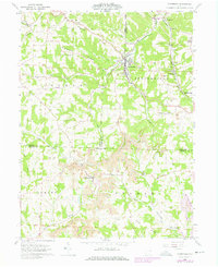
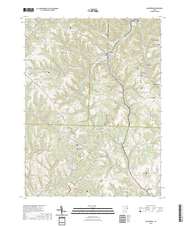
Amsterdam sits at the intersection of several regional routes, serving as a central hub in a landscape defined by sharp ridges and deep creek valleys. The village is surrounded by high ground such as Pigeon Ridge, Simmons Ridge, and Red Dog Ridge, which dictate the winding paths of roads like Amsterdam Rd SE and Steubenville Rd SE. This 2023 survey reveals a dense network of family and community burial grounds, including the Circle Green Methodist Episcopal Cem and the Greek Orthodox Cem, which point to the diverse heritage of early settlers in the Wolf Run and Circle Green areas.
Find a feature on this map
59 named features on this map. Tap any name to fly to it.
Don’t see what you’re looking for? This feature index may not catch every label — zoom into the map to look around manually.
Map Details
Editions of this 2023 Amsterdam Map
This is the sole edition of this map. No revisions or reprints were ever made.