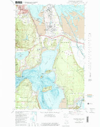
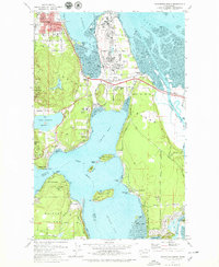
1978 Map of Anacortes South
USGS Topo · Published 1981About this map
Fidalgo Island is defined by a landscape of industrial infrastructure and coastal settlements at the end of the 1970s. Large oil refinery complexes dominate the northern neck of the island near Fidalgo Bay, while the Burlington Northern railroad lines connect the industrial waterfront to the interior. The map illustrates the interface between public lands and private development, featuring the extensive Deception Pass State Park and Reception Island State Park alongside residential areas like Similk Beach and Yokeko Point.
Find a feature on this map
76 named features on this map. Tap any name to fly to it.
Don’t see what you’re looking for? This feature index may not catch every label — zoom into the map to look around manually.
Map Details
Editions of this 1978 Anacortes South Map
3 editions found

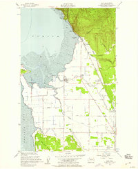
Other maps of this area

1911 · Mount Vernon
USGS Topo · 1:125,000

1918 · Samish Lake
USGS Topo · 1:62,500

1940 · Mt Vernon
USGS Topo · 1:62,500

1943 · Mt Vernon
USGS Topo · 1:62,500

1943 · Deception Pass
USGS Topo · 1:62,500

1943 · Anacortes
USGS Topo · 1:62,500

1951 · Deception Pass
USGS Topo · 1:62,500

1951 · Anacortes
USGS Topo · 1:62,500
1954 · Bow
USGS Topo · 1:24,000

1954 · Samish Lake
USGS Topo · 1:62,500