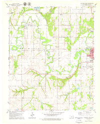
1979 Map of Anadarko West
USGS Topo · Published 1979About this map
The Washita River meanders through the heart of Caddo County, defining a landscape of agricultural lowlands and low ridges. In the late 1970s, the western edge of Anadarko serves as the primary hub, where the Riverside Indian Sch and Anadarko Muni Airport anchor the local community. The region's spiritual and social history is deeply etched into the land through rural landmarks like Red Stone Ch and Ware Chapel, alongside their associated burial grounds such as Red Stone Cem.
Find a feature on this map
46 named features on this map. Tap any name to fly to it.
Don’t see what you’re looking for? This feature index may not catch every label — zoom into the map to look around manually.
Map Details
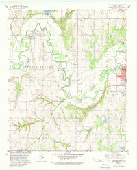
Editions of this 1979 Anadarko West Map
2 editions found
Other maps of this area

1945 · Anadarko
USGS Topo · 1:62,500

1949 · Cement
USGS Topo · 1:62,500

1951 · Fort Cobb
USGS Topo · 1:62,500

1955 · Lawton
USGS Topo · 1:250,000

1955 · Clinton
USGS Topo · 1:250,000

1956 · Boone
USGS Topo · 1:24,000
1956 · Cyril
USGS Topo · 1:24,000

1956 · Apache
USGS Topo · 1:24,000

1956 · Apache
USGS Topo · 1:62,500
1956 · Cement
USGS Topo · 1:62,500