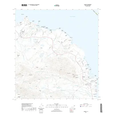
2017 Map of Anahola
USGS Topo · Published 2017About this map
The settlement of Anahola stands at the edge of Anahola Bay on the northeastern coast of Kauai, where the landscape is defined by its extensive system of agricultural water management. The interior of the quadrangle is marked by numerous reservoirs and streams, such as the Kaneha Reservoirs, Morita Reservoir, and Waiakalua Reservoir, which transition into the upper reaches of the Makaleha Mountains. Evidence of early community life is anchored by the Koolau Huila Church Cem near the northern coast.
Find a feature on this map
129 named features on this map. Tap any name to fly to it.
Don’t see what you’re looking for? This feature index may not catch every label — zoom into the map to look around manually.
Map Details
Editions of this 2017 Anahola Map
This is the sole edition of this map. No revisions or reprints were ever made.
Other maps of this area

1954 · Kauai
USGS Topo · 1:250,000

1963 · Anahola
USGS Topo · 1:24,000

1963 · Kapaa
USGS Topo · 1:24,000

1963 · Hanalei
USGS Topo · 1:24,000

1965 · Waialeale
USGS Topo · 1:24,000

1967 · Kauai
USGS Topo · 1:250,000

1970 · Kauai
USGS Topo · 1:250,000

1978 · Kapaa
USGS Topo · 1:24,000
1983 · Hanalei
USGS Topo · 1:24,000
1983 · Waialeale
USGS Topo · 1:24,000