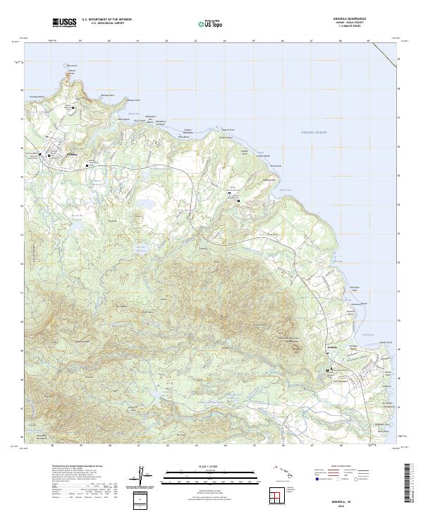
2024 Map of Anahola
USGS Topo · Published 2024About this map
Kilauea Point National Wildlife Refuge anchors the northern coastline of this Kauai survey, where the rugged topography of Crater Hill and Moku'ae'ae islet meet the Pacific. The landscape is defined by its complex water management systems, including the Kaneha Ditch and numerous reservoirs like Waiakalua Reservoir and Ka Loko Reservoir, which support the interior valleys. These engineering works reflect the area's agricultural history, particularly around Anahola Valley and the settlement of Anahola.
Find a feature on this map
134 named features on this map. Tap any name to fly to it.
Don’t see what you’re looking for? This feature index may not catch every label — zoom into the map to look around manually.
Map Details
Editions of this 2024 Anahola Map
This is the sole edition of this map. No revisions or reprints were ever made.
Other maps of this area

1954 · Kauai
USGS Topo · 1:250,000

1963 · Anahola
USGS Topo · 1:24,000

1963 · Kapaa
USGS Topo · 1:24,000

1963 · Hanalei
USGS Topo · 1:24,000

1965 · Waialeale
USGS Topo · 1:24,000

1967 · Kauai
USGS Topo · 1:250,000

1970 · Kauai
USGS Topo · 1:250,000

1978 · Kapaa
USGS Topo · 1:24,000
1983 · Hanalei
USGS Topo · 1:24,000
1983 · Waialeale
USGS Topo · 1:24,000