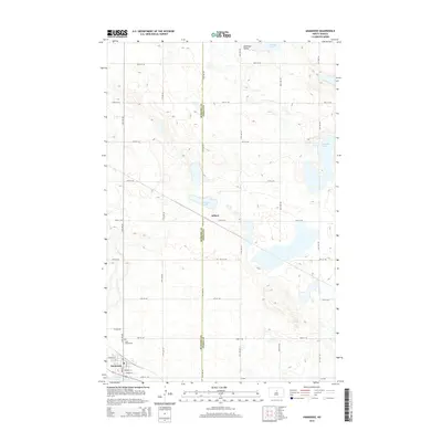
2014 Map of Anamoose
USGS Topo · Published 2014About this map
The Anamoose settlement and its surrounding prairie landscape define this portion of the North Dakota plains. Located at the intersection of local routes like 32nd St NE and 16th Ave NE, the town serves as a focal point for the region's agricultural transport. The Soo Line railroad cuts diagonally across the terrain, passing through the smaller siding area of Aylmer and past Aylmer Lake.
Find a feature on this map
32 named features on this map. Tap any name to fly to it.
Don’t see what you’re looking for? This feature index may not catch every label — zoom into the map to look around manually.
Map Details
Editions of this 2014 Anamoose Map
This is the sole edition of this map. No revisions or reprints were ever made.
Other maps of this area

1930 · Drake
USGS Topo · 1:62,500

1940 · Aylmer
USGS Topo · 1:62,500

1951 · Martin
USGS Topo · 1:24,000

1951 · Anamoose SW
USGS Topo · 1:24,000

1954 · Minot
USGS Topo · 1:250,000

1954 · McClusky
USGS Topo · 1:250,000

1957 · Rangeley SE
USGS Topo · 1:24,000

1958 · McClusky
USGS Topo · 1:250,000

1958 · Minot
USGS Topo · 1:250,000
1958 · Anamoose
USGS Topo · 1:24,000