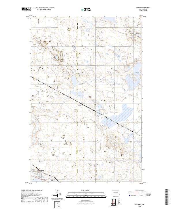
2024 Map of Anamoose
USGS Topo · Published 2024About this map
The town of Anamoose anchors the southwestern corner of this landscape, serving as a gateway to the pothole prairie region of North Dakota. This modern survey illustrates the persistent agricultural and conservation patterns of the Great Plains, featuring the Pierce County Waterfowl Production Area at its center. This protected habitat, surrounding Aylmer Lake, highlights the importance of the region's wetlands for migratory birds. The map also documents the small settlement of Aylmer, situated at a rural crossroads north of the town center.
Find a feature on this map
35 named features on this map. Tap any name to fly to it.
Don’t see what you’re looking for? This feature index may not catch every label — zoom into the map to look around manually.
Map Details
Editions of this 2024 Anamoose Map
This is the sole edition of this map. No revisions or reprints were ever made.
Other maps of this area

1930 · Drake
USGS Topo · 1:62,500

1940 · Aylmer
USGS Topo · 1:62,500

1951 · Martin
USGS Topo · 1:24,000

1951 · Anamoose SW
USGS Topo · 1:24,000

1954 · Minot
USGS Topo · 1:250,000

1954 · McClusky
USGS Topo · 1:250,000

1957 · Rangeley SE
USGS Topo · 1:24,000

1958 · McClusky
USGS Topo · 1:250,000

1958 · Minot
USGS Topo · 1:250,000
1958 · Anamoose
USGS Topo · 1:24,000