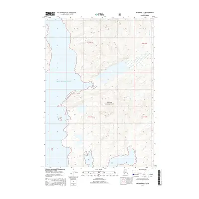
2016 Map of Anchorage A-2 SE
USGS Topo · Published 2016About this map
Prince William Sound defines the western coastline of this glacial landscape, where the tides meet the steep drainage systems of the Chugach National Forest. The map documents a rugged wilderness dominated by the Brilliant Glacier in the north, which feeds into the Miners River system. This river flows south into the calm waters of Miners Lake before emptying into Miners Bay. The complex shoreline includes the deep inlet of Wells Bay, illustrating the dramatic transition between high-elevation ice fields and protected marine environments. With no established roads or settlements shown, the topography emphasizes the area's role as a pristine maritime corridor and a key segment of the Alaskan national forest system during the early 21st century.
Find a feature on this map
12 named features on this map. Tap any name to fly to it.
Don’t see what you’re looking for? This feature index may not catch every label — zoom into the map to look around manually.
Map Details
Editions of this 2016 Anchorage A-2 SE Map
This is the sole edition of this map. No revisions or reprints were ever made.
Other maps of this area

1951 · Seward
USGS Topo · 1:250,000

1951 · Anchorage
USGS Topo · 1:250,000

1951 · Seward D-2
USGS Topo · 1:63,360

1951 · Seward D-1
USGS Topo · 1:63,360

1952 · Seward D-1
USGS Topo · 1:63,360

1952 · Seward D-2
USGS Topo · 1:63,360

1953 · Seward
USGS Topo · 1:250,000

1959 · Seward
USGS Topo · 1:250,000

1960 · Anchorage A-2
USGS Topo · 1:63,360

1960 · Anchorage A-1
USGS Topo · 1:63,360