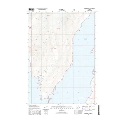
2016 Map of Anchorage A-3 SW
USGS Topo · Published 2016About this map
Chugach National Forest encompasses the entirety of this coastal Alaskan landscape, where the Chugach Mountains meet the northern reaches of Prince William Sound. The terrain is defined by dramatic elevation changes, from the sea-level inlets of Barry Arm to the high peaks of Mt Coville, Mt Emerson, and Mt Curtis. Along the western edge, the Coxe Glacier flows toward the sound, illustrating the active glacial environment of this region. The shoreline is marked by prominent navigational landmarks like Pakenham Point and Coghill Point, which have long served as orienting features for those navigating these cold northern waters. This topographic study reflects the coastal geography of the Unorganized Borough in the mid-2010s, detailing a wilderness devoid of roads or settlements.
Find a feature on this map
13 named features on this map. Tap any name to fly to it.
Don’t see what you’re looking for? This feature index may not catch every label — zoom into the map to look around manually.
Map Details
Editions of this 2016 Anchorage A-3 SW Map
This is the sole edition of this map. No revisions or reprints were ever made.
Other maps of this area

1951 · Seward
USGS Topo · 1:250,000

1951 · Anchorage
USGS Topo · 1:250,000

1951 · Seward D-4
USGS Topo · 1:63,360

1951 · Seward D-3
USGS Topo · 1:63,360

1952 · Seward D-3
USGS Topo · 1:63,360

1952 · Seward D-4
USGS Topo · 1:63,360

1953 · Seward
USGS Topo · 1:250,000

1959 · Seward
USGS Topo · 1:250,000

1960 · Anchorage A-4
USGS Topo · 1:63,360

1960 · Anchorage A-3
USGS Topo · 1:63,360