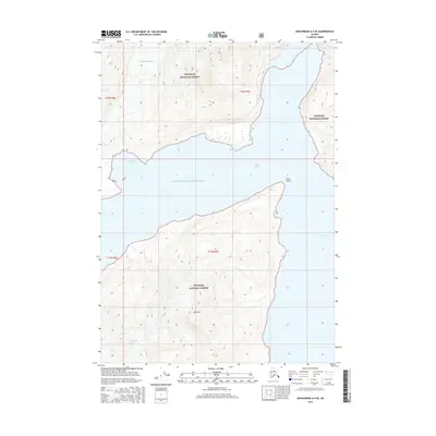
2016 Map of Anchorage A-4 SE
USGS Topo · Published 2016About this map
Serpentine Glacier and Toboggan Glacier dominate this coastal landscape within the Chugach National Forest, illustrating the dramatic glacial activity characteristic of the northern Prince William Sound region. The map details the complex shoreline where the ice meets the sea, notably at Serpentine Cove and the narrow passage of Doran Strait. High peaks such as Mt Doran rise sharply from the water, while Point Doran and Barry Arm mark the intersection of deep-water inlets and massive ice flows. This survey provides a precise view of the 2016 glacial margins, including the position of Coxe Glacier in the northeastern corner, offering a vital record for researchers tracking the movement and recession of coastal Alaskan ice fields over time.
Find a feature on this map
14 named features on this map. Tap any name to fly to it.
Don’t see what you’re looking for? This feature index may not catch every label — zoom into the map to look around manually.
Map Details
Editions of this 2016 Anchorage A-4 SE Map
This is the sole edition of this map. No revisions or reprints were ever made.
Other maps of this area

1951 · Seward
USGS Topo · 1:250,000

1951 · Anchorage
USGS Topo · 1:250,000

1951 · Seward D-4
USGS Topo · 1:63,360

1951 · Seward D-3
USGS Topo · 1:63,360

1952 · Seward D-3
USGS Topo · 1:63,360

1952 · Seward D-4
USGS Topo · 1:63,360

1953 · Seward
USGS Topo · 1:250,000

1959 · Seward
USGS Topo · 1:250,000

1960 · Anchorage A-4
USGS Topo · 1:63,360

1960 · Anchorage A-3
USGS Topo · 1:63,360