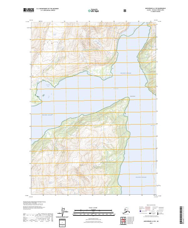
2023 Map of Anchorage A-4 SE
USGS Topo · Published 2023About this map
Chugach National Forest encompasses this glaciated coastal landscape, where ice and sea meet in the complex fjords of southern Alaska. The topography is defined by massive ice fields including Serpentine Glacier, Cascade Glacier, and Toboggan Glacier, which drain into the saltwater reaches of Pacific Ocean. This specific environment illustrates the dramatic vertical relief of the region, anchored by the 3,450-foot summit of Mt Doran. The interaction between the maritime climate and the high alpine terrain is evident in the numerous named glaciers that terminate near or into the water. Navigational features like Doran Strait, Serpentine Cove, and the prominent Point Doran mark the jagged shoreline, providing crucial orientation points in a wilderness area devoid of roads or permanent human settlements.
Find a feature on this map
16 named features on this map. Tap any name to fly to it.
Don’t see what you’re looking for? This feature index may not catch every label — zoom into the map to look around manually.
Map Details
Editions of this 2023 Anchorage A-4 SE Map
This is the sole edition of this map. No revisions or reprints were ever made.
Other maps of this area

1951 · Seward
USGS Topo · 1:250,000

1951 · Anchorage
USGS Topo · 1:250,000

1951 · Seward D-4
USGS Topo · 1:63,360

1951 · Seward D-3
USGS Topo · 1:63,360

1952 · Seward D-3
USGS Topo · 1:63,360

1952 · Seward D-4
USGS Topo · 1:63,360

1953 · Seward
USGS Topo · 1:250,000

1959 · Seward
USGS Topo · 1:250,000

1960 · Anchorage A-4
USGS Topo · 1:63,360

1960 · Anchorage A-3
USGS Topo · 1:63,360