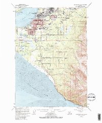
1952 Map of Anchorage A-8
USGS Topo · Published 1970About this map
Anchorage and its mid-century suburbs spread across the lowland between Knik Arm and Turnagain Arm in this post-war survey. The map records a city in rapid transition, where the established grid of the downtown core and Mountain View meets newer residential developments like Artesian Village, Spenard, and Turnagain Heights. Major transportation hubs are prominently featured, including the central Merrill Airport and the expanding International Airport to the southwest, while the Alaska Railroad skirts the coastline.
Find a feature on this map
75 named features on this map. Tap any name to fly to it.
Don’t see what you’re looking for? This feature index may not catch every label — zoom into the map to look around manually.
Map Details
Editions of this 1952 Anchorage A-8 Map
4 editions found

Other maps of this area

1944 · Kenai
USGS Topo · 1:250,000

1949 · Tyonek
USGS Topo · 1:250,000

1950 · Kenai
USGS Topo · 1:250,000

1951 · Seward
USGS Topo · 1:250,000

1951 · Anchorage
USGS Topo · 1:250,000

1951 · Tyonek
USGS Topo · 1:250,000

1951 · Kenai D-1
USGS Topo · 1:63,360

1951 · Seward D-8
USGS Topo · 1:63,360

1951 · Seward D-7
USGS Topo · 1:63,360

1951 · Tyonek A-1
USGS Topo · 1:63,360