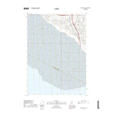
2019 Map of Anchorage A-8 SW
USGS Topo · Published 2019About this map
The Anchorage Municipality Kenai Peninsula Borough boundary divides this coastal landscape where urban expansion meets the waters of the Turnagain Arm. This survey captures a highly developed transportation corridor defined by the Old Seward Highway and Minnesota Drive SB, illustrating the modern infrastructure supporting the southern reach of the city. Significant aviation history is represented by Sky Harbor Airport and Flying Crown Airport, while community landmarks like the Angelus Memorial Park and Evergreen Memorial Cem provide important reference points for local history and genealogy. The residential network is dense, featuring names like Tulin Park Loop and Klatt Road New, showing the transition from the city center to the suburban edge near Rabbit Creek.
Find a feature on this map
71 named features on this map. Tap any name to fly to it.
Don’t see what you’re looking for? This feature index may not catch every label — zoom into the map to look around manually.
Map Details
Editions of this 2019 Anchorage A-8 SW Map
This is the sole edition of this map. No revisions or reprints were ever made.
Other maps of this area

1944 · Kenai
USGS Topo · 1:250,000

1949 · Tyonek
USGS Topo · 1:250,000

1950 · Kenai
USGS Topo · 1:250,000

1951 · Seward
USGS Topo · 1:250,000

1951 · Anchorage
USGS Topo · 1:250,000

1951 · Tyonek
USGS Topo · 1:250,000

1951 · Kenai D-1
USGS Topo · 1:63,360

1951 · Seward D-8
USGS Topo · 1:63,360

1951 · Tyonek A-1
USGS Topo · 1:63,360

1952 · Tyonek A-1
USGS Topo · 1:63,360