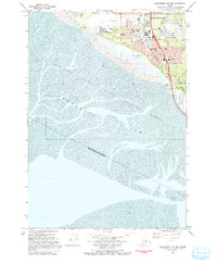
1993 Map of Anchorage A-8 SW
USGS Topo · Published 1993About this map
The Anchorage Coastal State Wildlife Refuge dominates the coastline of the Turnagain Arm in this detailed look at South Anchorage during the early 1990s. The map illustrates the suburban expansion of the city as residential blocks and parks like Timberlane Park and Johns Park push against the natural mudflats of the Cook Inlet. The settlement of Klatt appears alongside several community institutions, including the Klatt Community Sch and the Evergreen Memorial Cem.
Find a feature on this map
32 named features on this map. Tap any name to fly to it.
Don’t see what you’re looking for? This feature index may not catch every label — zoom into the map to look around manually.
Map Details
Editions of this 1993 Anchorage A-8 SW Map
This is the sole edition of this map. No revisions or reprints were ever made.
Other maps of this area

1944 · Kenai
USGS Topo · 1:250,000

1949 · Tyonek
USGS Topo · 1:250,000

1950 · Kenai
USGS Topo · 1:250,000

1951 · Seward
USGS Topo · 1:250,000

1951 · Anchorage
USGS Topo · 1:250,000

1951 · Tyonek
USGS Topo · 1:250,000

1951 · Kenai D-1
USGS Topo · 1:63,360

1951 · Seward D-8
USGS Topo · 1:63,360

1951 · Tyonek A-1
USGS Topo · 1:63,360

1952 · Tyonek A-1
USGS Topo · 1:63,360