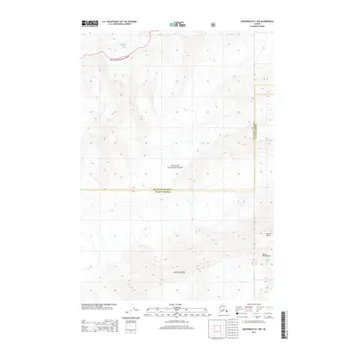
2013 Map of Anchorage B-1 NW
USGS Topo · Published 2013About this map
The high alpine wilderness of the Chugach National Forest dominates this 2013 survey, capturing a landscape defined by massive ice fields and high peaks along the border of Matanuska-Susitna and Valdez-Cordova. The map document is a study in glaciology, tracing the northern reaches of the Harvard Glacier and the Matanuska Glacier, alongside the headwaters of the Yale Glacier and Columbia Glacier. These ice bodies carve through the Dora Keen Range, where extreme elevations are marked by landmarks such as Mount Witherspoon and Mount Edison. This topographical record provides a precise look at the glacial extents and drainage patterns in one of Alaska's most inaccessible regions, where the lack of human infrastructure highlights the purely natural state of the Chugach mountains at the beginning of the twenty-first century.
Find a feature on this map
10 named features on this map. Tap any name to fly to it.
Don’t see what you’re looking for? This feature index may not catch every label — zoom into the map to look around manually.
Map Details
Editions of this 2013 Anchorage B-1 NW Map
This is the sole edition of this map. No revisions or reprints were ever made.
Other maps of this area

1951 · Anchorage
USGS Topo · 1:250,000

1960 · Anchorage C-2
USGS Topo · 1:63,360

1960 · Anchorage B-1
USGS Topo · 1:63,360

1960 · Anchorage B-2
USGS Topo · 1:63,360

1960 · Anchorage C-1
USGS Topo · 1:63,360

1962 · Anchorage
USGS Topo · 1:250,000

1979 · Anchorage
USGS Topo · 1:250,000
1993 · Anchorage C-2
USGS Topo · 1:63,360
2013 · Anchorage C-1 SW
USGS Topo · 1:25,000
2013 · Anchorage B-2 NE
USGS Topo · 1:25,000