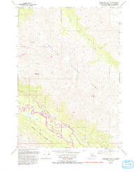
1979 Map of Anchorage B-7 SE
USGS Topo · Published 1993About this map
Chugach State Park dominates this mountain landscape where the Eagle River winds through the valley floor. The map documents a rugged wilderness setting marked by prominent summits like Mount Magnificent and Mount Significant, alongside several numbered creek drainages including Sixmile Creek and Ninemile Creek. While the terrain remains largely undeveloped, small named outposts and clearings such as Lannum, Stanley, and Tucker appear in the southern half of the quadrangle. A network of foot and pack routes, including the Lower Eagle River Trail and the Valley Trail, trace the low-lying areas near the riverbanks. The presence of a Landing Strip near the confluence of several mountain streams highlights the reliance on aerial access for these remote interior Alaskan locations during the late twentieth century.
Find a feature on this map
24 named features on this map. Tap any name to fly to it.
Don’t see what you’re looking for? This feature index may not catch every label — zoom into the map to look around manually.
Map Details
Editions of this 1979 Anchorage B-7 SE Map
2 editions found
Other maps of this area

1951 · Anchorage
USGS Topo · 1:250,000

1960 · Anchorage A-6
USGS Topo · 1:63,360

1960 · Anchorage B-7
USGS Topo · 1:63,360

1960 · Anchorage B-6
USGS Topo · 1:63,360

1960 · Anchorage A-7
USGS Topo · 1:63,360

1962 · Anchorage
USGS Topo · 1:250,000

1979 · Anchorage B-6 NW
USGS Topo · 1:25,000

1979 · Anchorage B-7 SW
USGS Topo · 1:25,000
1979 · Anchorage B-7 SE
USGS Topo · 1:25,000
1979 · Anchorage B-7 NE
USGS Topo · 1:25,000