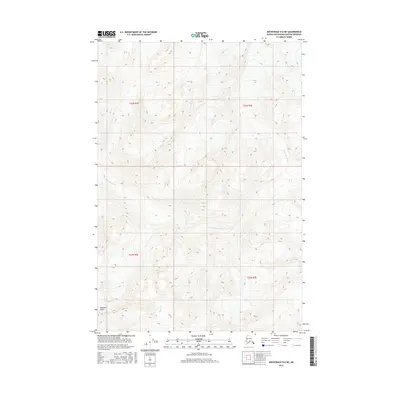
2016 Map of Anchorage D-6 NE
USGS Topo · Published 2016About this map
Montana Peak anchors the southwestern corner of this landscape in the Matanuska-Susitna Borough, rising above a network of alpine drainage systems. The Kashwitna River meanders across the central and western reaches of the quadrangle, carving a path through the elevation contours that define this wilderness area. To the south, the headwaters of Moose Cr emerge, feeding into the larger regional hydrological system. The map is primarily characterized by its extreme relief and the absence of developed infrastructure, illustrating the undisturbed state of the Talkeetna Mountains backcountry in the early 21st century. Surveyed township boundaries, including t22n r2e and t21n r3e, provide the only formal human overlay on this complex terrain of ridges and river valleys.
Find a feature on this map
7 named features on this map. Tap any name to fly to it.
Don’t see what you’re looking for? This feature index may not catch every label — zoom into the map to look around manually.
Map Details
Editions of this 2016 Anchorage D-6 NE Map
This is the sole edition of this map. No revisions or reprints were ever made.
Other maps of this area

1949 · Anchorage D-5
USGS Topo · 1:63,360

1949 · Talkeetna Mountains A-4
USGS Topo · 1:63,360

1950 · Talkeetna Mountains
USGS Topo · 1:250,000

1950 · Anchorage D-6
USGS Topo · 1:63,360

1950 · Talkeetna Mountains A-5
USGS Topo · 1:63,360

1951 · Anchorage
USGS Topo · 1:250,000

1952 · Anchorage D-6
USGS Topo · 1:63,360

1952 · Anchorage D-5
USGS Topo · 1:63,360
1952 · Talkeetna Mountains A-5
USGS Topo · 1:63,360
1954 · Talkeetna Mountains A-4
USGS Topo · 1:63,360