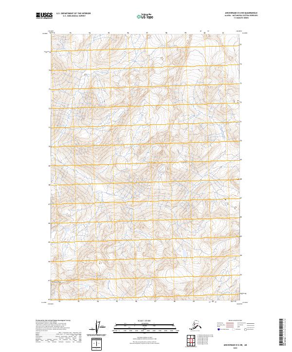
2023 Map of Anchorage D-6 NE
USGS Topo · Published 2023About this map
Montana Peak dominates the southwestern corner of this landscape in the Matanuska-Susitna Borough, where steep elevation changes define the drainages of the Kashwitna River and Moose Creek. This 2023 survey by the U.S. Geological Survey shows a wilderness area largely devoid of structural development, emphasizing the natural hydrography and terrain of the Talkeetna Mountains region. The map provides a contemporary record of the public land survey system divisions across t22n r2e, t22n r3e, t21n r2e, and t21n r3e. The absence of roads or established settlements illustrates the remote character of this Alaskan interior, making it a critical reference for understanding the modern topographic state of these mountain watercourses.
Find a feature on this map
7 named features on this map. Tap any name to fly to it.
Don’t see what you’re looking for? This feature index may not catch every label — zoom into the map to look around manually.
Map Details
Editions of this 2023 Anchorage D-6 NE Map
This is the sole edition of this map. No revisions or reprints were ever made.
Other maps of this area

1949 · Anchorage D-5
USGS Topo · 1:63,360

1949 · Talkeetna Mountains A-4
USGS Topo · 1:63,360

1950 · Talkeetna Mountains
USGS Topo · 1:250,000

1950 · Anchorage D-6
USGS Topo · 1:63,360

1950 · Talkeetna Mountains A-5
USGS Topo · 1:63,360

1951 · Anchorage
USGS Topo · 1:250,000

1952 · Anchorage D-6
USGS Topo · 1:63,360

1952 · Anchorage D-5
USGS Topo · 1:63,360
1952 · Talkeetna Mountains A-5
USGS Topo · 1:63,360
1954 · Talkeetna Mountains A-4
USGS Topo · 1:63,360