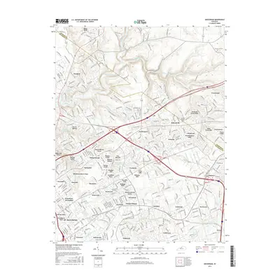
2016 Map of Anchorage
USGS Topo · Published 2016About this map
Pewee Valley and the surrounding residential corridors of Jefferson and Oldham Counties appear here in their modern 21st-century configuration. The landscape is defined by its extensive network of named neighborhoods and suburban developments, such as Barbourmeade, Springdale, and Coldstream Worthington Hills. These communities are woven between significant watercourses, including the winding Harrods Creek and the Middle Fork Beargrass Creek. The area maintains connections to its older settlement roots through landmarks like the Harrods Creek Cemetery and the village of O'Bannon.
Find a feature on this map
358 named features on this map. Tap any name to fly to it.
Don’t see what you’re looking for? This feature index may not catch every label — zoom into the map to look around manually.
Map Details
Editions of this 2016 Anchorage Map
This is the sole edition of this map. No revisions or reprints were ever made.
Other maps of this area

1905 · Prospect
USGS Topo · 1:62,500

1907 · Louisville
USGS Topo · 1:62,500

1912 · Prospect
USGS Topo · 1:62,500

1929 · Taylorsville
USGS Topo · 1:62,500

1932 · La Grange
USGS Topo · 1:62,500

1937 · Jeffersonville
USGS Topo · 1:24,000

1937 · Charlestown
USGS Topo · 1:24,000

1938 · Owen
USGS Topo · 1:24,000

1946 · Jeffersonville
USGS Topo · 1:24,000

1948 · Owen
USGS Topo · 1:24,000