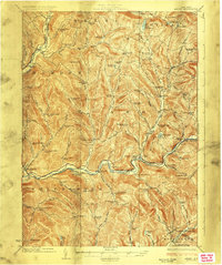
1924 Map of Andes
USGS Topo · Published 1924About this map
The East Branch Delaware River carves a deep path through the Catskill mountains in this 1924 survey, revealing a landscape of small agricultural hamlets and isolated mountain schoolhouses before the mid-century valley inundations. Significant settlements such as Pepacton, Shavertown, and Union Grove are shown along the riverbanks, serving as hubs for the surrounding hollows. Higher in the hills, the rural community structure is visible through dozens of family-named schools like the Mary Smith School and Tiffany Hollow School, alongside landmarks such as Cabin Hill Church.
Find a feature on this map
128 named features on this map. Tap any name to fly to it.
Don’t see what you’re looking for? This feature index may not catch every label — zoom into the map to look around manually.
Map Details
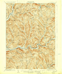
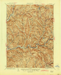
Editions of this 1924 Andes Map
4 editions found

Other maps of this area

1901 · Margaretville
USGS Topo · 1:62,500

1904 · Hobart
USGS Topo · 1:62,500

1904 · Margaretville
USGS Topo · 1:62,500

1909 · Delhi
USGS Topo · 1:62,500

1910 · Neversink
USGS Topo · 1:62,500

1911 · Delhi
USGS Topo · 1:62,500

1915 · Oneonta
USGS Topo · 1:62,500

1918 · Oneonta
USGS Topo · 1:62,500

1920 · Long Eddy
USGS Topo · 1:62,500

1921 · Long Eddy
USGS Topo · 1:48,000