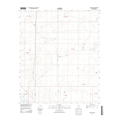
2013 Map of Angel Draw
USGS Topo · Published 2013About this map
Angel Draw and Scanlon Draw carve through this arid landscape of Eddy County, defining the drainage patterns of an area characterized by scattered ranching operations and vast open terrain. The map highlights the ranching heritage of the region with labeled properties such as Angel Ranch, Bates Ranch, and Murray Ranch, which serve as the primary landmarks in this sparsely populated territory. In the southwest corner, the northern reaches of Lake Avalon and the white expanse of Alkali Lake near Saladar Flat indicate the seasonal water sources and alkali deposits typical of the Pecos Valley region.
Find a feature on this map
27 named features on this map. Tap any name to fly to it.
Don’t see what you’re looking for? This feature index may not catch every label — zoom into the map to look around manually.
Map Details
Editions of this 2013 Angel Draw Map
This is the sole edition of this map. No revisions or reprints were ever made.
Other maps of this area

1939 · Carlsbad
USGS Topo · 1:62,500

1943 · Carlsbad
USGS Topo · 1:62,500

1943 · Oil City
USGS Topo · 1:62,500

1943 · West Carlsbad
USGS Topo · 1:62,500

1945 · West Carlsbad
USGS Topo · 1:62,500

1954 · Carlsbad
USGS Topo · 1:250,000

1955 · Lake Mc Millan North
USGS Topo · 1:24,000

1955 · Lake Mc Millan South
USGS Topo · 1:24,000

1958 · Carlsbad
USGS Topo · 1:250,000

1978 · Artesia
USGS Topo · 1:100,000