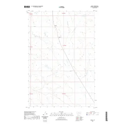
2020 Map of Angela
USGS Topo · Published 2020About this map
Angela serves as the central hub of this Rosebud County landscape, situated along the primary thoroughfare that bisects the region. The settlement is anchored by its Po and is flanked by a complex network of seasonal drainages and springs that define the local topography. This area is characterized by a reliance on surface water management, evidenced by features such as Bones Reservoir and Fulton Spring.
Find a feature on this map
21 named features on this map. Tap any name to fly to it.
Don’t see what you’re looking for? This feature index may not catch every label — zoom into the map to look around manually.
Map Details
Editions of this 2020 Angela Map
This is the sole edition of this map. No revisions or reprints were ever made.
Other maps of this area

1954 · Forsyth
USGS Topo · 1:250,000

1957 · Forsyth
USGS Topo · 1:250,000

1958 · Forsyth
USGS Topo · 1:250,000

1965 · Rock Springs School
USGS Topo · 1:24,000
1965 · Red Buttes
USGS Topo · 1:24,000
1965 · Crow Rock SE
USGS Topo · 1:24,000
1969 · Angela NE
USGS Topo · 1:24,000

1969 · Wild Horse Pass SE
USGS Topo · 1:24,000
1969 · N Bar Coulee
USGS Topo · 1:24,000
1969 · Alkali Creek
USGS Topo · 1:24,000