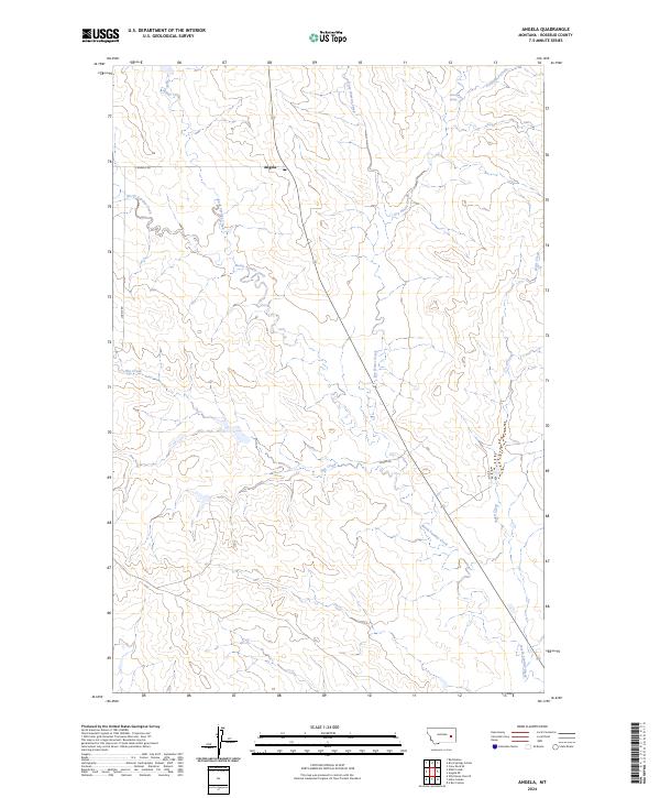
2024 Map of Angela
USGS Topo · Published 2024About this map
Angela serves as the central hub of this Rosebud County landscape, marked by its Po and a network of rural roads including S Angela Rd and Lockie Rd. The terrain is defined by a dense drainage system of prairie creeks that carve through the high plains, most notably North Sunday Creek and the strikingly named Dirty Woman Creek. This 2024 survey illustrates a contemporary view of the region's ranching infrastructure, where water sources like Fulton Spring and the persistent paths of Butte Creek and Dry House Creek dictate the layout of the land. The presence of established township lines and sections, such as t11n r44e, highlights the enduring structure of the Public Land Survey System in eastern Montana. Collectors and local historians can trace the intersection of major county routes like Mcrae Rd as they navigate this sparsely populated but well-documented territory.
Find a feature on this map
19 named features on this map. Tap any name to fly to it.
Don’t see what you’re looking for? This feature index may not catch every label — zoom into the map to look around manually.
Map Details
Editions of this 2024 Angela Map
This is the sole edition of this map. No revisions or reprints were ever made.
Other maps of this area

1954 · Forsyth
USGS Topo · 1:250,000

1957 · Forsyth
USGS Topo · 1:250,000

1958 · Forsyth
USGS Topo · 1:250,000

1965 · Rock Springs School
USGS Topo · 1:24,000
1965 · Red Buttes
USGS Topo · 1:24,000
1965 · Crow Rock SE
USGS Topo · 1:24,000
1969 · Angela NE
USGS Topo · 1:24,000

1969 · Wild Horse Pass SE
USGS Topo · 1:24,000
1969 · N Bar Coulee
USGS Topo · 1:24,000
1969 · Alkali Creek
USGS Topo · 1:24,000