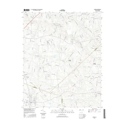
2016 Map of Angier
USGS Topo · Published 2016About this map
Angier sits at the southern edge of this landscape where the boundaries of Wake, Harnett, and Johnston counties converge. The area is defined by a dense network of residential subdivisions and rural homesteads, reflecting the modern expansion of the Research Triangle region. Local aviation history is represented by Triple W Airport and Fuquay-Angier Field, while the topography is characterized by the numerous creeks and millponds that feed the regional drainage system. Water bodies like Julians Lake, Powell Lake, and Holts Pond are scattered across the terrain, connected by the meandering paths of Black Creek and Little Creek. Smaller settlements and junctions such as Mount Pleasant, Ogburn Crossroads, and Kennebec remain as distinct nodes among the burgeoning network of newly named roads and residential lanes.
Find a feature on this map
185 named features on this map. Tap any name to fly to it.
Don’t see what you’re looking for? This feature index may not catch every label — zoom into the map to look around manually.
Map Details
Editions of this 2016 Angier Map
This is the sole edition of this map. No revisions or reprints were ever made.
Other maps of this area

1953 · Raleigh
USGS Topo · 1:250,000

1954 · Raleigh
USGS Topo · 1:250,000

1964 · Lake Wheeler
USGS Topo · 1:24,000

1964 · Garner
USGS Topo · 1:24,000

1964 · Angier
USGS Topo · 1:24,000

1964 · Edmondson
USGS Topo · 1:24,000

1964 · Garner
USGS Topo · 1:62,500

1973 · Benson
USGS Topo · 1:24,000

1973 · Coats
USGS Topo · 1:24,000

1974 · Apex
USGS Topo · 1:24,000