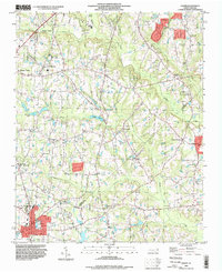
1993 Map of Angier
USGS Topo · Published 1998About this map
Angier anchors the southern portion of this landscape where the borders of Wake, Johnston, and Harnett counties converge. In the late twentieth century, the area maintained a distinct rural character defined by a network of drainage basins including Black Creek and Middle Creek. The settlement pattern follows a series of ridges and crossroads, with clusters of activity at Willow Springs and Ogburn Crossroads. Small-scale aviation is a notable feature of the local infrastructure, represented by the Triple W Air Park and Fuquay-Angier Airfield.
Find a feature on this map
28 named features on this map. Tap any name to fly to it.
Don’t see what you’re looking for? This feature index may not catch every label — zoom into the map to look around manually.
Map Details
Editions of this 1993 Angier Map
This is the sole edition of this map. No revisions or reprints were ever made.
Other maps of this area

1953 · Raleigh
USGS Topo · 1:250,000

1954 · Raleigh
USGS Topo · 1:250,000

1964 · Lake Wheeler
USGS Topo · 1:24,000

1964 · Garner
USGS Topo · 1:24,000

1964 · Angier
USGS Topo · 1:24,000

1964 · Edmondson
USGS Topo · 1:24,000

1964 · Garner
USGS Topo · 1:62,500

1973 · Benson
USGS Topo · 1:24,000

1973 · Coats
USGS Topo · 1:24,000

1974 · Apex
USGS Topo · 1:24,000