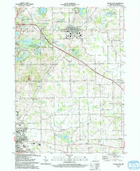
1993 Map of Angola East
USGS Topo · Published 1993About this map
Fremont stands as a central hub in this northeastern Indiana landscape, where the local grid meets the sweep of the Indiana East-West Toll Road. The area is defined by its glacial hydrology, with numerous basins like Marsh Lake and Lake Minifenokee supporting the sprawling Marsh Lake Wetlands State Fish and Wildlife Area. This intersection of conservation land and infrastructure is punctuated by small residential clusters such as Briarwood and the northern reaches of Angola.
Find a feature on this map
54 named features on this map. Tap any name to fly to it.
Don’t see what you’re looking for? This feature index may not catch every label — zoom into the map to look around manually.
Map Details
Editions of this 1993 Angola East Map
This is the sole edition of this map. No revisions or reprints were ever made.
Other maps of this area

1939 · Hamilton
USGS Topo · 1:24,000

1939 · Angola East
USGS Topo · 1:24,000

1939 · Clear Lake
USGS Topo · 1:24,000

1940 · Metz
USGS Topo · 1:24,000

1940 · Clear Lake
USGS Topo · 1:24,000

1941 · Angola West
USGS Topo · 1:24,000

1942 · Ashley
USGS Topo · 1:24,000

1942 · Angola West
USGS Topo · 1:24,000

1947 · Angola East
USGS Topo · 1:24,000

1948 · Hamilton
USGS Topo · 1:24,000