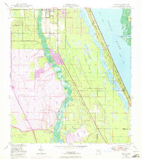
1948 Map of Ankona
USGS Topo · Published 1972About this map
The North Fork St Lucie River and Indian River dominate this coastal survey, where the early infrastructure of the Florida Atlantic coast is clearly visible. Settlements like Ankona and White City are situated along the Florida East Coast railroad, reflecting the transportation-dependent growth of the region. The landscape transitions from the developed corridors of Collins Park Estates and River Park to the complex wetlands of The Savannas and the barrier topography of Hutchinson Island.
Find a feature on this map
28 named features on this map. Tap any name to fly to it.
Don’t see what you’re looking for? This feature index may not catch every label — zoom into the map to look around manually.
Map Details
Editions of this 1948 Ankona Map
4 editions found
Other maps of this area

1948 · Palm City
USGS Topo · 1:24,000

1948 · Ankona
USGS Topo · 1:24,000

1948 · St. Lucie Inlet
USGS Topo · 1:24,000

1948 · Eden
USGS Topo · 1:24,000

1949 · Fort Pierce
USGS Topo · 1:24,000

1949 · Fort Pierce NW
USGS Topo · 1:24,000

1950 · St. Lucie Inlet
USGS Topo · 1:24,000

1950 · Ankona
USGS Topo · 1:24,000

1950 · Fort Pierce
USGS Topo · 1:24,000

1950 · Palm City
USGS Topo · 1:24,000