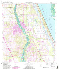
1948 Map of Ankona
USGS Topo · Published 1983About this map
North Fork St Lucie River meanders through this coastal landscape, serving as a primary corridor for the developing communities of Port St Lucie and River Park. The geography is defined by the narrow strip of Hutchinson Island protecting the Indian River and the Intracoastal Waterway, with the vast wetlands of the Savannas State Preserve and the Savannas dominating the eastern shoreline. Transport infrastructure is prominent, featuring the Florida East Coast Railway and Floridas Turnpike, which parallel the coast and facilitate movement through established settlements like White City, Ankona, and Walton. This 1948 survey, with 1980s revisions, illustrates a period of significant inland expansion, particularly around Collins Park Estates, as residential developments began to push westward from the historical riverfront hamlets and the isolated beauty of Spruce Bluff.
Find a feature on this map
27 named features on this map. Tap any name to fly to it.
Don’t see what you’re looking for? This feature index may not catch every label — zoom into the map to look around manually.
Map Details
Editions of this 1948 Ankona Map
4 editions found
Other maps of this area

1948 · Palm City
USGS Topo · 1:24,000

1948 · Ankona
USGS Topo · 1:24,000

1948 · St. Lucie Inlet
USGS Topo · 1:24,000

1948 · Eden
USGS Topo · 1:24,000

1949 · Fort Pierce
USGS Topo · 1:24,000

1949 · Fort Pierce NW
USGS Topo · 1:24,000

1950 · St. Lucie Inlet
USGS Topo · 1:24,000

1950 · Ankona
USGS Topo · 1:24,000

1950 · Fort Pierce
USGS Topo · 1:24,000

1950 · Palm City
USGS Topo · 1:24,000