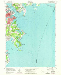
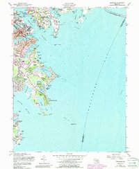
1957 Map of Annapolis
USGS Topo · Published 1971About this map
The US Naval Academy and the historic streets of Annapolis anchor this coastal survey, where the Severn River meets the Chesapeake Bay. The map documents a landscape defined by its maritime connections, showing the dense waterfront developments of Eastport and West Annapolis alongside the extensive grounds of the US Naval Reservation. Further south, the map reveals a series of established waterfront communities like Hillsmere Shores, Bay Ridge, and the historically significant Highland Beach. The network of creeks including Spa Creek, Back Creek, and Duvall Creek illustrates the intricate shoreline of the era. Landmarks such as the Capitol, St Johns College, and the isolated Thomas Point Shoal Lighthouse emphasize the city's role as both a center of government and a critical navigational waypoint.
Find a feature on this map
100 named features on this map. Tap any name to fly to it.
Don’t see what you’re looking for? This feature index may not catch every label — zoom into the map to look around manually.
Map Details
Editions of this 1957 Annapolis Map
5 editions found
Other maps of this area

1892 · Owensville
USGS Topo · 1:62,500

1892 · Annapolis
USGS Topo · 1:62,500

1893 · North Point
USGS Topo · 1:62,500

1894 · Relay
USGS Topo · 1:62,500

1895 · Owensville
USGS Topo · 1:62,500

1898 · Choptank
USGS Topo · 1:125,000

1898 · Tolchester
USGS Topo · 1:125,000

1899 · Patuxent
USGS Topo · 1:125,000

1903 · Tolchester
USGS Topo · 1:125,000

1904 · North Point
USGS Topo · 1:62,500