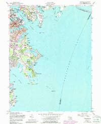
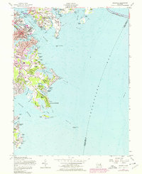
1957 Map of Annapolis
USGS Topo · Published 1988About this map
The U S Naval Academy and the historic core of Annapolis anchor this mid-century survey of the Maryland coast. The map traces the dense urban development of the state capital, including the State Capitol and St Johns College, before moving south into a string of waterfront communities. Distinctive shoreline settlements like Highland Beach, Arundel on the Bay, and Bay Ridge Beach line the peninsula between the Severn River and the South River.
Find a feature on this map
80 named features on this map. Tap any name to fly to it.
Don’t see what you’re looking for? This feature index may not catch every label — zoom into the map to look around manually.
Map Details
Editions of this 1957 Annapolis Map
5 editions found
Other maps of this area

1892 · Owensville
USGS Topo · 1:62,500

1892 · Annapolis
USGS Topo · 1:62,500

1893 · North Point
USGS Topo · 1:62,500

1894 · Relay
USGS Topo · 1:62,500

1895 · Owensville
USGS Topo · 1:62,500

1898 · Choptank
USGS Topo · 1:125,000

1898 · Tolchester
USGS Topo · 1:125,000

1899 · Patuxent
USGS Topo · 1:125,000

1903 · Tolchester
USGS Topo · 1:125,000

1904 · North Point
USGS Topo · 1:62,500