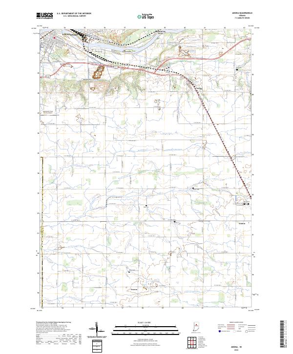
2022 Map of Anoka
USGS Topo · Published 2022About this map
The Wabash River corridor near Logansport anchors this study of Cass County’s agricultural heartland. The landscape is defined by an intricate network of drainage ditches and creeks, including Rock Cr, Dry Run Ditch, and Ansberry Bird Ditch, which support the intensive farming of the T26N and T27N ranges. Prominent terrain features like Potawatomi Point and Kienly Island overlook the river valley, while the inland areas are dotted with the small hubs of Anoka, Walton, and Deacon. Genealogists will find a wealth of burial sites dispersed across the townships, from the Walton Cem near the town center to more rural family plots such as West Cem, Ramer Cem, and Shaff Cem. The proximity of the Logansport/Cass County Airport and the modern Logansport Bypass indicates the area's continued role as a regional transit and transportation node.
Find a feature on this map
65 named features on this map. Tap any name to fly to it.
Don’t see what you’re looking for? This feature index may not catch every label — zoom into the map to look around manually.
Map Details
Editions of this 2022 Anoka Map
This is the sole edition of this map. No revisions or reprints were ever made.
Other maps of this area

1951 · Onward
USGS Topo · 1:24,000

1951 · Twelve Mile
USGS Topo · 1:24,000

1953 · Danville
USGS Topo · 1:250,000

1955 · Danville
USGS Topo · 1:250,000

1955 · Logansport
USGS Topo · 1:24,000

1955 · Anoka
USGS Topo · 1:24,000

1956 · Danville
USGS Topo · 1:250,000

1959 · Galveston
USGS Topo · 1:24,000

1959 · Young America
USGS Topo · 1:24,000

1960 · Lucerne
USGS Topo · 1:24,000