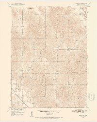
1951 Map of Ansley SE
USGS Topo · Published 1953About this map
Ansley serves as the focal point for this Custer County survey, situated at the intersection of the Chicago Burlington and Quincy railroad and local transport routes. The landscape transitions from the drainage of Mud Creek in the south toward the dissected uplands of Westerville, Myrtle, and Algernon. This mid-century view captures a dense network of rural infrastructure, where five distinct schoolhouses—including Hopewell Sch and Box Elder Sch—supported scattered farming families.
Find a feature on this map
22 named features on this map. Tap any name to fly to it.
Don’t see what you’re looking for? This feature index may not catch every label — zoom into the map to look around manually.
Map Details
Editions of this 1951 Ansley SE Map
2 editions found
Other maps of this area

1951 · Westerville
USGS Topo · 1:24,000

1951 · Ansley
USGS Topo · 1:24,000

1951 · Ansley NE
USGS Topo · 1:24,000

1951 · Arcadia West
USGS Topo · 1:24,000

1951 · Mason City NW
USGS Topo · 1:24,000

1951 · Mason City
USGS Topo · 1:24,000

1951 · Ansley SE
USGS Topo · 1:24,000

1951 · Arcadia SW
USGS Topo · 1:24,000

1951 · Litchfield
USGS Topo · 1:24,000

1955 · Broken Bow
USGS Topo · 1:250,000