
1963 Map of Ante
USGS Topo · Published 1980About this map
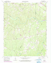
Meherrin River flows across this rural landscape at the border of Brunswick and Greensville counties, anchoring a network of small agricultural settlements and crossroads during the mid-twentieth century. The area is defined by its deep community roots, evidenced by numerous country churches such as Rising Star Ch, Mt Vernon Ch, and Independence Ch. The Norfolk Franklin and Danville railroad cuts across the northern edge of the map, serving small hubs like Totaro and Radium. Local industry and services are represented by Webbs Mill on Reedy Creek, while the presence of the Scott Lewis Sch and family-named landmarks like Hobbs Chapel and the Phillips Cem provide valuable touchpoints for genealogical research. The map captures the quiet transition of this Virginia tobacco country as it appeared in the early 1960s, with later updates documenting subtle changes in the road network.
Find a feature on this map
30 named features on this map. Tap any name to fly to it.
Don’t see what you’re looking for? This feature index may not catch every label — zoom into the map to look around manually.
Map Details
Editions of this 1963 Ante Map

Other maps of this area

1918 · Lawrenceville
USGS Topo · 1:62,500

1919 · Mc Kenney
USGS Topo · 1:48,000

1919 · White Plains
USGS Topo · 1:48,000

1919 · Emporia
USGS Topo · 1:62,500

1920 · Lawrenceville
USGS Topo · 1:48,000

1920 · White Plains
USGS Topo · 1:62,500

1921 · Mc Kenney
USGS Topo · 1:62,500

1921 · Lawrenceville
USGS Topo · 1:62,500

1942 · Lawrenceville
USGS Topo · 1:62,500

1942 · Emporia
USGS Topo · 1:62,500