
1962 Map of Antelope Creek SE
USGS Topo · Published 1965About this map
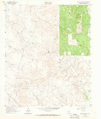
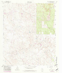
Swenson Field dominates the southern portion of this landscape in Throckmorton County, where the Texas rangeland is marked by early-1960s industrial activity and cattle operations. The map documents a network of Oil Wells and a prominent Pipeline cutting across the terrain, reflecting the mid-century energy production that defined this region. Water management and drainage are central to the map's detail, with seasonal flows like Antelope Creek, Wolf Creek, and Sulphur Creek branching through the contours. A remote Landing Strip and various Drill Holes indicate the active exploration and transport needs of the era. The northeast corner reveals more densely wooded areas around Gray Back Creek and Horse Creek, providing a clear look at the contrast between the open flats and the drainage breaks of North Central Texas.
Find a feature on this map
14 named features on this map. Tap any name to fly to it.
Don’t see what you’re looking for? This feature index may not catch every label — zoom into the map to look around manually.
Map Details
Editions of this 1962 Antelope Creek SE Map
3 editions found
Other maps of this area

1954 · Wichita Falls
USGS Topo · 1:250,000

1958 · Wichita Falls
USGS Topo · 1:250,000

1962 · Antelope Creek SW
USGS Topo · 1:24,000

1962 · Antelope Creek NE
USGS Topo · 1:24,000

1962 · Antelope Creek NW
USGS Topo · 1:24,000

1965 · Reynolds Bend NW
USGS Topo · 1:24,000

1966 · Rock Canyon
USGS Topo · 1:24,000

1966 · Westover SW
USGS Topo · 1:24,000

1966 · Tonk Creek
USGS Topo · 1:24,000
1966 · Throckmorton
USGS Topo · 1:24,000