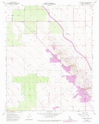
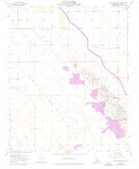
1954 Map of Antelope Plain
USGS Topo · Published 1982About this map
The Antelope Plain unfolds as a landscape defined by industrial development and water infrastructure in this mid-century survey, which incorporates revisions through the early 1980s. The eastern portion is dominated by the Lost Hills, where a dense concentration of Oil Wells, Oil Tanks, and an Oil Sump reveal the intensity of local petroleum extraction. This industrial activity contrasts with the managed water systems visible across the arid terrain, most notably the California Aqueduct cutting diagonally through the quadrangle with markers like Mile 194 and Mile 195. Smaller-scale infrastructure, including a Windmill, various Water Tanks, and a Water Tank Well, highlights the constant effort to secure water for both industry and livestock. The map provides a precise view of the transition from the open flats of the plain to the resource-rich rising ground of the hills.
Find a feature on this map
19 named features on this map. Tap any name to fly to it.
Don’t see what you’re looking for? This feature index may not catch every label — zoom into the map to look around manually.
Map Details
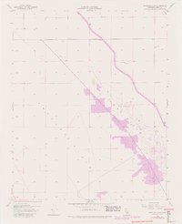
Editions of this 1954 Antelope Plain Map
6 editions found
Other maps of this area

1914 · Lost Hills
USGS Topo · 1:125,000

1930 · Avenal Gap
USGS Topo · 1:31,680

1932 · Antelope Plain
USGS Topo · 1:31,680

1932 · West of Goose Lake
USGS Topo · 1:31,680

1932 · Reynolds Ranch
USGS Topo · 1:31,680

1932 · West Camp
USGS Topo · 1:31,680

1932 · Lone Tree Well
USGS Topo · 1:31,680

1933 · Avenal Gap
USGS Topo · 1:31,680

1934 · West of Goose Lake
USGS Topo · 1:31,680
1935 · West Camp
USGS Topo · 1:31,680